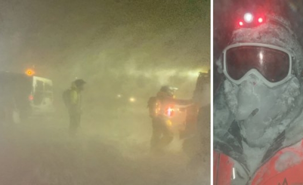


The Icelandic Met Office (IMO) has issued a warning: Strong gale force wind or mean wind speed of 20 m/s (45 mph/72 km/h) is expected in all parts of Iceland today (Thursday). That wind speed is expected to remain in the southeast part on Friday.
The wind speed will be stronger south of Vatnajökull glacier in the afternoon today and IMO warns of possible sand storm in the area. Iceland’s Ring Road (Highway 1) is south of the glacier along the south coast. Jökulsárlón glacial lagoon is in this area.
Read more: Is it our car? Travellers find their vehicle floating among icebergs at Jökulsárlón glacial lagoon
IMO’s forecast
Thursday: Moderate snowfall and blowing snow in the north and east, but sleet at the east coast. Partly cloudy in the southern part with chances of some minor snow showers. Temperature 0 to -4 degrees Celsius (32-25 F) but above freezing level at the east coast.
Friday: North and northwest 13-18 m/s (29-40 mph/47-65 km/h), but 18-23 m/s (40-51 mph – 65-83 km/h) in gusts in the southeastern part.
Mainly dry in the south, but snow in the north. Considerable precipitaiton in the north part in the evening. Temperature 0 to -4 degrees Celsius (32-25 F), but temperature just above freezing point by the east coast.