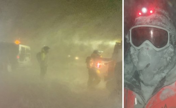
The IMO has issued a severe weather warning for all parts of the country today, Thursday. A low pressure area will track across the country, beginning along the south coast and gradually moving north, with winds reaching 20-28 metres per second (45-63 mph/72-101 km per hour). There is great likelihood of isolated higher gusts in exposed areas such as by Eyjafjöll mountain range, Mýrdalur and Öræfi near Vatnajökull glacier.

Motorists can expect some road closures due to the storm, according to the Icelandic Road and Coastal Administration. Hellisheiði, Þrengsli and Mosfellsheiði roads in South Iceland and Kjalarnes road (west Iceland) are likely to become closed to traffic at noon today. The Civil Protection in Iceland advises against travel in all parts of the country during the storm.
Read more: 'Lets have a look outside and see what the weather is like here in Iceland'
The weather will begin to worsen in the south and west at around noon, peaking in late afternoon. The storm will hit northern regions and Westfjords by evening – ramming the Westfjords with particular force. The area also faces high risk for avalanches. Ten avalanches were reported in the Westfjords earlier this week.
The storm will bring moderate to heavy precipitation – snow, sleet or rain.
According to the IMO a similar low pressure area formed over the country in 1968, hitting the Westfjords badly. The powerful storm sank two British trawlers and a smaller fishing boat that were at sea off the Westfjords. Seven fishermen died in the storm.
The IMO has issued a severe weather warning for all parts of the country today, Thursday. A low pressure area will track across the country, beginning along the south coast and gradually moving north, with winds reaching 20-28 metres per second (45-63 mph/72-101 km per hour). There is great likelihood of isolated higher gusts in exposed areas such as by Eyjafjöll mountain range, Mýrdalur and Öræfi near Vatnajökull glacier.

Motorists can expect some road closures due to the storm, according to the Icelandic Road and Coastal Administration. Hellisheiði, Þrengsli and Mosfellsheiði roads in South Iceland and Kjalarnes road (west Iceland) are likely to become closed to traffic at noon today. The Civil Protection in Iceland advises against travel in all parts of the country during the storm.
Read more: 'Lets have a look outside and see what the weather is like here in Iceland'
The weather will begin to worsen in the south and west at around noon, peaking in late afternoon. The storm will hit northern regions and Westfjords by evening – ramming the Westfjords with particular force. The area also faces high risk for avalanches. Ten avalanches were reported in the Westfjords earlier this week.
The storm will bring moderate to heavy precipitation – snow, sleet or rain.
According to the IMO a similar low pressure area formed over the country in 1968, hitting the Westfjords badly. The powerful storm sank two British trawlers and a smaller fishing boat that were at sea off the Westfjords. Seven fishermen died in the storm.


