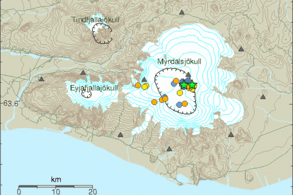
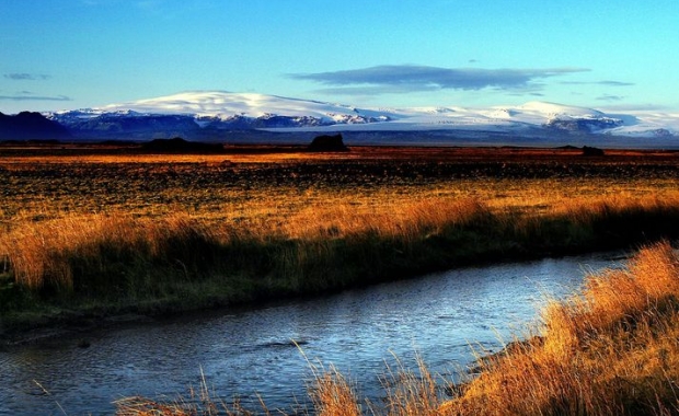
The subglacial volcano Katla trembled over the weekend, with two sharp earthquake swarms on Friday and Saturday evenings. The quakes are the latest tremors in an episode of heightened activity which began in 2010, following an eruption Eyjafjallajökull, a glacier located to the west of Mýrdalsjökull glacier. Katla is hidden beneath Mýrdalsjökull.

The Icelandic Meteorological Office sees no imminent threat of eruption in the volcano, which could generate an eruption ten times the size of the 2010 Eyjafjallajökull
Both earthquakes took place in the eastern part of the Katla caldera at a depth of only 100 m (330 ft) below the surface.
Read more: Two of Iceland's most powerful volcanoes tremble: Earthquakes in Bárðarbunga and Katla
The earlier quake, a 3.1 magnitude quake was detected by the Icelandic Meteorological Office shortly after 21:00 on Friday evening. This quake was followed by a dozen smaller quakes. The activity picked up again on Saturday evening, when a 3.2 magnitude quake was detected east of the location of the first quake. This quake was also followed by a swarm of half a dozen smaller quakes.
The volcano has seen significant seismic activity in the past few weeks, raising concerns that an eruption might be more likely. Katla is long overdue for an eruption, having erupted historically once every 60-80 years.
Read more: Why the constant earthquakes? Iceland is slowly being torn apart
The last eruption took place in 1918. However, a seismologist at the Icelandic Meteorological Office told RÚV that it was not at all unusual for seismic activity to pick up in Katla in early summer: As the ice cap, which covers the sub-glacial volcano, thins with warming temperatures the pressure weighing on the caldera is reduced, which in turn causes increased seismic activity.
The subglacial volcano Katla trembled over the weekend, with two sharp earthquake swarms on Friday and Saturday evenings. The quakes are the latest tremors in an episode of heightened activity which began in 2010, following an eruption Eyjafjallajökull, a glacier located to the west of Mýrdalsjökull glacier. Katla is hidden beneath Mýrdalsjökull.

The Icelandic Meteorological Office sees no imminent threat of eruption in the volcano, which could generate an eruption ten times the size of the 2010 Eyjafjallajökull
Both earthquakes took place in the eastern part of the Katla caldera at a depth of only 100 m (330 ft) below the surface.
Read more: Two of Iceland's most powerful volcanoes tremble: Earthquakes in Bárðarbunga and Katla
The earlier quake, a 3.1 magnitude quake was detected by the Icelandic Meteorological Office shortly after 21:00 on Friday evening. This quake was followed by a dozen smaller quakes. The activity picked up again on Saturday evening, when a 3.2 magnitude quake was detected east of the location of the first quake. This quake was also followed by a swarm of half a dozen smaller quakes.
The volcano has seen significant seismic activity in the past few weeks, raising concerns that an eruption might be more likely. Katla is long overdue for an eruption, having erupted historically once every 60-80 years.
Read more: Why the constant earthquakes? Iceland is slowly being torn apart
The last eruption took place in 1918. However, a seismologist at the Icelandic Meteorological Office told RÚV that it was not at all unusual for seismic activity to pick up in Katla in early summer: As the ice cap, which covers the sub-glacial volcano, thins with warming temperatures the pressure weighing on the caldera is reduced, which in turn causes increased seismic activity.


