Planning a visit to Iceland? Trying to map out hiking trails or looking to locate a place you read about online? Chances are you will rely on google maps, the go-to map on the web. Unfortunately there are numerous examples of errors in google maps, including some which have sent unsuspecting travelers onto closed roads or to the wrong destinations.
Read more: Don't trust Google Maps blindly: Company fails to update maps despite repeated requests
We at Iceland Insider therefore compiled a list of the major free online map services. We recommend that readers use at least one of these in addition to google maps to verify directions or place names before heading out.
The phonebook

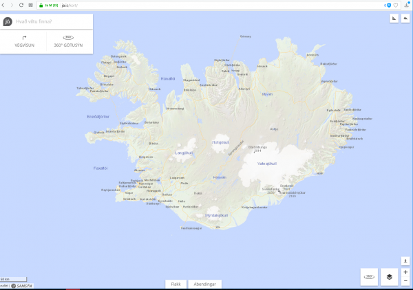
The white pages, ja.is, is of course the best place to find the address of any business or individual. Just type in what you are looking for and the location appears on the map. Looking for Svignaskarð on ja.is directs you immediately to the correct destination.
Ja.is also offers a 360° street-view feature, which helps you orient yourself. Using Ja.is alongside Google maps might in most cases be the most sensible way to verify you are headed in the right direction.
The Road and Coastal Administration

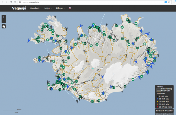
The IRCA offers a Road Map which allows you to see the numbers of every road along with up-to-date road conditions, including windspeed. Online webcams also help you judge driving conditions.
If you are planning to travel during the winter, or are heading off the Ring Road you should always check the map of the IRCA to make sure you are not venturing onto closed or impassable roads.
The Land Survey of Iceland

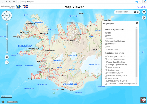
The LSI offers the most authorative map of Iceland available anywhere. The interactive map, which lets you switch between a road map, an atlas or a satellite image, among other things, includes a search function that lets you search for any place name in Iceland. Wonder what that hill or creek is called? You can look it up on the LSI map.
Read more: GPS equipment directs travellers to Þingvellir farm instead of the historic site
The only problem is that some place names show up in more than one location in Iceland. A good example is Þingvellir, the first stop on the Golden Circle. There are three places called Þingvellir in Iceland, each in a different part of the country: The National Park on the Golden Circle, a farmstead on Snæfellsnes peninsula in West Iceland, and an abandoned farm in North East Iceland. The instructions on the LSI site are still mostly in Icelandic, so you will need to verify you have the right location with some other resource.
Map.is

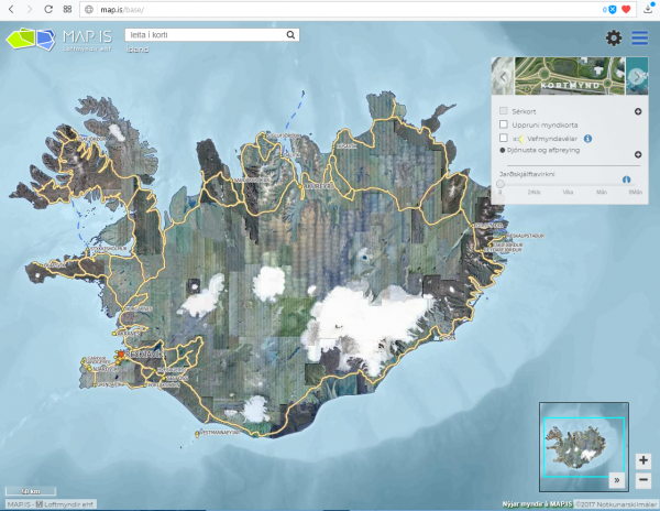
We at Iceland Insider have found that the interactive map provided by map.is is usually the most reliable and most user friendly of the online maps of Iceland. You can choose from either a map background or aerial photos. The aerial photos offered by Map.is have a far better resolution than the satellite images of LSI, and unlike Google Maps it is 100% reliable. In addition to place names and roads, it includes many hiking paths.
Unfortunately map.is suffers from the same problem as the Land Survey maps, namely it only in Icelandic.
Read more: Local author helps you pronounce all those impossible Icelandic place names
Planning a visit to Iceland? Trying to map out hiking trails or looking to locate a place you read about online? Chances are you will rely on google maps, the go-to map on the web. Unfortunately there are numerous examples of errors in google maps, including some which have sent unsuspecting travelers onto closed roads or to the wrong destinations.
Read more: Don't trust Google Maps blindly: Company fails to update maps despite repeated requests
We at Iceland Insider therefore compiled a list of the major free online map services. We recommend that readers use at least one of these in addition to google maps to verify directions or place names before heading out.
The phonebook

The white pages, ja.is, is of course the best place to find the address of any business or individual. Just type in what you are looking for and the location appears on the map. Looking for Svignaskarð on ja.is directs you immediately to the correct destination.
Ja.is also offers a 360° street-view feature, which helps you orient yourself. Using Ja.is alongside Google maps might in most cases be the most sensible way to verify you are headed in the right direction.
The Road and Coastal Administration

The IRCA offers a Road Map which allows you to see the numbers of every road along with up-to-date road conditions, including windspeed. Online webcams also help you judge driving conditions.
If you are planning to travel during the winter, or are heading off the Ring Road you should always check the map of the IRCA to make sure you are not venturing onto closed or impassable roads.
The Land Survey of Iceland

The LSI offers the most authorative map of Iceland available anywhere. The interactive map, which lets you switch between a road map, an atlas or a satellite image, among other things, includes a search function that lets you search for any place name in Iceland. Wonder what that hill or creek is called? You can look it up on the LSI map.
Read more: GPS equipment directs travellers to Þingvellir farm instead of the historic site
The only problem is that some place names show up in more than one location in Iceland. A good example is Þingvellir, the first stop on the Golden Circle. There are three places called Þingvellir in Iceland, each in a different part of the country: The National Park on the Golden Circle, a farmstead on Snæfellsnes peninsula in West Iceland, and an abandoned farm in North East Iceland. The instructions on the LSI site are still mostly in Icelandic, so you will need to verify you have the right location with some other resource.
Map.is

We at Iceland Insider have found that the interactive map provided by map.is is usually the most reliable and most user friendly of the online maps of Iceland. You can choose from either a map background or aerial photos. The aerial photos offered by Map.is have a far better resolution than the satellite images of LSI, and unlike Google Maps it is 100% reliable. In addition to place names and roads, it includes many hiking paths.
Unfortunately map.is suffers from the same problem as the Land Survey maps, namely it only in Icelandic.
Read more: Local author helps you pronounce all those impossible Icelandic place names


