One of the greatest hiking destinations in the Central Highlands is Mt Strútur, rising 968 m (3,175 ft) above sea level in the rugged highlands north of Mýrdalsjökull glacier. Strútur is in good company, since the neighborhood, Fjallabak region, is packed with spectacular natural sites. Mt. Strútur is located right between Torfajökull glacier, a stratovolcano renowned for its rock formations, and The Green Pyramid, Mt. Mælifell, one of the most majestic mountains in the Central Highlands.
Read more: Beautiful drone footage of Mt. Mælifell on Mælifellssandur sand desert in the central highlands
Mt. Strútur is surrounded by numerous great hiking trails, including the 75 km long Strútsstígur trail which starts in Hvanngil cabin, one of the stops on Laugavegurinn trail. Strútsstígur is a spectacular alternative to the popular Fimmvörðuháls and Laugavegur trails, both of which can be started from Þórsmörk nature preserve. Strútsstígur takes you through the rugged mountains and highland deserts north of Mýrdalsjökull to Langisjór lake. Strútsskáli hut is one of the stops along the trail.
Summiting Mt. Strútur adds a day to the Strútsstígur hike. Hiking to the top takes half a day: the trail runs along the north- and eastern slopes of the mountain and then up a path in the southeastern slope. The summit offers a spectacular view of Mýrdalsjökull glacier which covers the monster volcano Katla, which has been making headlines in recent days, as well as Mælifellssandur black sand desert and Mt Mælifell.
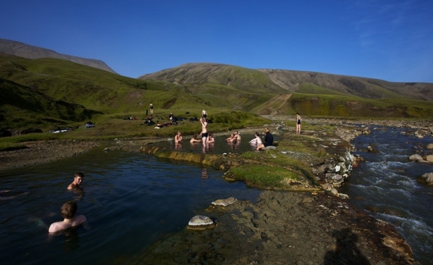
The perfect finish to a day of hiking in Mt. Strútur is of course a visit to Strútslaug geothermal pool, one of the most beautiful geothermal pools in the Central Highlands. To get to the pool one needs to walk a few kilometers to the east from the mountain to Hólmsárbotnar plains in the foothills of Torfajökull glacier. The pool can only be reached by foot, and is an hour's hike from Strútsskáli cabin. Hikers could also spend the night, as a grassy field right next to the pool offers the perfect natural campsite.

Mt Strútur Photo/Ólafur Már

Amazing hiking trails Photo/Ólafur Már

Krókagil on Strútsstígur trail Photo/Ólafur Már

The view from the tallest peak of Torfajökull glacier Photo/Ólafur Már

Relaxing in Strútslaug Photo/Ólafur Már

Strútsskáli hut Photo/Ólafur Már
You can find the above locations on the map below – but when hiking in Iceland you should always use a printed map – and a reliable local online map. Map.is provides the best aerial photo maps of the Central Highlands. Ja.is has good aerial photo maps of many lowland areas ans well as a GPS feature, while the most consistently reliable online maps are those provided by the Icelandic Geological Survey. Google Maps cannot be trusted, since many locations are both incorrectly placed and incorrectly named. The overlay of road-maps and aerial photos on Google maps is also frequently way off.
Read more: The best free online maps of Iceland
One of the greatest hiking destinations in the Central Highlands is Mt Strútur, rising 968 m (3,175 ft) above sea level in the rugged highlands north of Mýrdalsjökull glacier. Strútur is in good company, since the neighborhood, Fjallabak region, is packed with spectacular natural sites. Mt. Strútur is located right between Torfajökull glacier, a stratovolcano renowned for its rock formations, and The Green Pyramid, Mt. Mælifell, one of the most majestic mountains in the Central Highlands.
Read more: Beautiful drone footage of Mt. Mælifell on Mælifellssandur sand desert in the central highlands
Mt. Strútur is surrounded by numerous great hiking trails, including the 75 km long Strútsstígur trail which starts in Hvanngil cabin, one of the stops on Laugavegurinn trail. Strútsstígur is a spectacular alternative to the popular Fimmvörðuháls and Laugavegur trails, both of which can be started from Þórsmörk nature preserve. Strútsstígur takes you through the rugged mountains and highland deserts north of Mýrdalsjökull to Langisjór lake. Strútsskáli hut is one of the stops along the trail.
Summiting Mt. Strútur adds a day to the Strútsstígur hike. Hiking to the top takes half a day: the trail runs along the north- and eastern slopes of the mountain and then up a path in the southeastern slope. The summit offers a spectacular view of Mýrdalsjökull glacier which covers the monster volcano Katla, which has been making headlines in recent days, as well as Mælifellssandur black sand desert and Mt Mælifell.
The perfect finish to a day of hiking in Mt. Strútur is of course a visit to Strútslaug geothermal pool, one of the most beautiful geothermal pools in the Central Highlands. To get to the pool one needs to walk a few kilometers to the east from the mountain to Hólmsárbotnar plains in the foothills of Torfajökull glacier. The pool can only be reached by foot, and is an hour's hike from Strútsskáli cabin. Hikers could also spend the night, as a grassy field right next to the pool offers the perfect natural campsite.
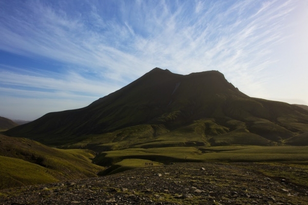
Mt Strútur Photo/Ólafur Már
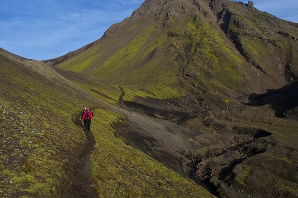
Amazing hiking trails Photo/Ólafur Már
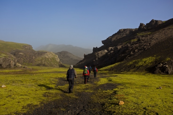
Krókagil on Strútsstígur trail Photo/Ólafur Már
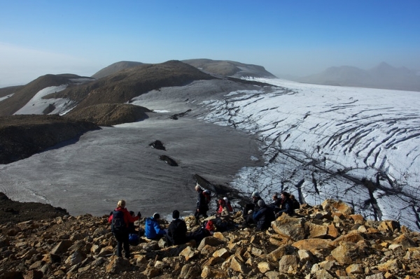
The view from the tallest peak of Torfajökull glacier Photo/Ólafur Már
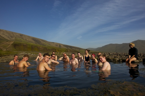
Relaxing in Strútslaug Photo/Ólafur Már
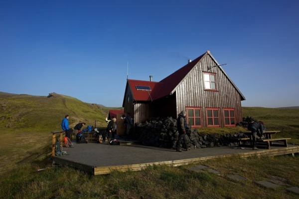
Strútsskáli hut Photo/Ólafur Már
You can find the above locations on the map below – but when hiking in Iceland you should always use a printed map – and a reliable local online map. Map.is provides the best aerial photo maps of the Central Highlands. Ja.is has good aerial photo maps of many lowland areas ans well as a GPS feature, while the most consistently reliable online maps are those provided by the Icelandic Geological Survey. Google Maps cannot be trusted, since many locations are both incorrectly placed and incorrectly named. The overlay of road-maps and aerial photos on Google maps is also frequently way off.
Read more: The best free online maps of Iceland


