

NASA's fantastic Earth Observatory page has published a great feature on how the ice cap of Mýrdalsjökull glacier has changed in 28 years. The changes are evident in two satellite images, the first captured on September 16th, 1986, and the second on September 20, 2014 (you can inspect the changes in the great Image Comparison mode on the page).
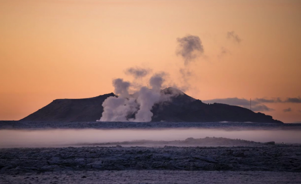
Mýrdalsjökull is Iceland's fourth largest ice cap and the home to Katla, one of Iceland’s most feared volcanoes. The closely monitored magma chamber of Katla is only 2 km (1.24 mi) below the top of Mýrdalsjökull ice cap. Katla last erupted in 1918. Until then, eruptions at an interval of 13 to 95 years marked its history. Volcanologist expect it to blow its top any day now.
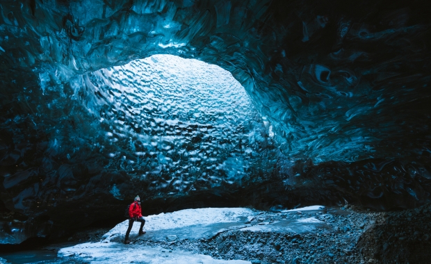
Sólheimajökull, the long outlet glacier on the southwest side of Mýrdalsjökull, is a very popular travel destination in South Iceland. It's close to the Ring route with a good parking space close by and it's easily accessible to hikers.
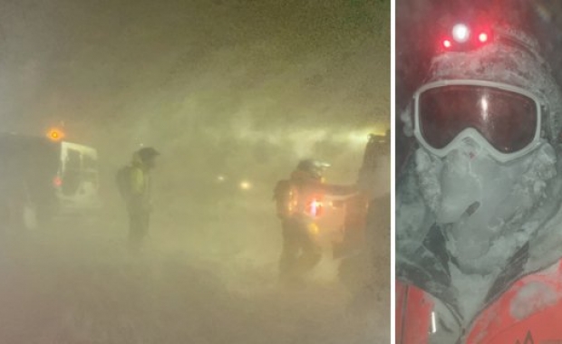
This last summer travellers noticed the smell of sulfuric gases near rivers close to Sólheimajökull. The road to the glacier was closed off for a short period and local rescue units patrolled the area as scientist believed the front of the outlet glacier could explode at any moment due to massive amount of water accumulated below it. The outburst came through without any dramatic consequence and travel restrictions were lifted.
One notable example mentioned in the Earth Observatory's story is how Sólheimajökull has retreated up to 50 meters (164 feet) every year since 1986.
NASA's fantastic Earth Observatory page has published a great feature on how the ice cap of Mýrdalsjökull glacier has changed in 28 years. The changes are evident in two satellite images, the first captured on September 16th, 1986, and the second on September 20, 2014 (you can inspect the changes in the great Image Comparison mode on the page).
Mýrdalsjökull is Iceland's fourth largest ice cap and the home to Katla, one of Iceland’s most feared volcanoes. The closely monitored magma chamber of Katla is only 2 km (1.24 mi) below the top of Mýrdalsjökull ice cap. Katla last erupted in 1918. Until then, eruptions at an interval of 13 to 95 years marked its history. Volcanologist expect it to blow its top any day now.
Sólheimajökull, the long outlet glacier on the southwest side of Mýrdalsjökull, is a very popular travel destination in South Iceland. It's close to the Ring route with a good parking space close by and it's easily accessible to hikers.
This last summer travellers noticed the smell of sulfuric gases near rivers close to Sólheimajökull. The road to the glacier was closed off for a short period and local rescue units patrolled the area as scientist believed the front of the outlet glacier could explode at any moment due to massive amount of water accumulated below it. The outburst came through without any dramatic consequence and travel restrictions were lifted.
One notable example mentioned in the Earth Observatory's story is how Sólheimajökull has retreated up to 50 meters (164 feet) every year since 1986.