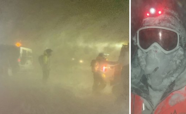


The Icelandic Road and Coastal Administration (IRCA) has closed roads F206 and F249 to Lakagígar (Laki Craters) and Þórsmörk nature reserve due to increased flow and levels of rivers.
The Lakagígar (Laki craters) in South Iceland is a magnificent 25 km (15.5 mi) long row of 135 craters west of Vatnajökull glacier, formed during the biggest volcanic eruption ever recorded in Iceland’s history (1783-1874).
Þórsmörk nature reserve is located in Iceland’s south central highlands north of glaciers Eyjafjallajökull and Mýrdalsjökull.
The highland road over Arnarvatnsheiði plateau from Surtshellir cave to Arnarvatn stóra lake remains closed. The plateau is in the northwestern part of the central highlands, north of Langjökull, Iceland's second largest glacier.
IRCA reminds travellers that information about conditions of roads in the central highlands is limited as the seasonal service in the area stopped 1 September. Please notice that highland roads are only meant for large vehicles equipped with 4×4.
Read more: Tips on how to navigate the rough, Icelandic mountain roads
Information on mountain roads is available on IRCA’s website, including the current condition of the condition of mountain roads and other roads on around the country.