One of two UNESCO-recognized areas of international geological significance in Iceland, the Reykjanes Geopark is a unique area. Sitting on the doorstep of Reykjavík, the area is full of natural and geological wonders, rugged lava fields, geothermal areas, and active volcanoes. Still, even though virtually all visitors to Iceland drive through the park on their way from the airport to the Capital region, it is frequently overlooked by visitors.

A barren desolate landscape
On Reykjanes peninsula, the Mid-Atlantic Ridge rises above sea level. The ridge, which stretches beneath the Atlantic Ocean from the Arctic to the Antarctic, is formed because the tectonic plates on either side are drifting 2 centimetres (0.8 inches) annually in opposite directions. Along the ridge, magma wells up, creating the longest mountain range on earth. The Reykjanes peninsula is in fact the only place on Earth where you can actually walk along the ridge, seeing up close how the forces of nature constantly create new land.
The 20 meter (66 feet) long footbridge, spanning one of the many fissures created by the drifting apart of the tectonic plates, has been built near the village of Hafnir on the west coast of Reykjanes peninsula, to symbolically bridge the continents

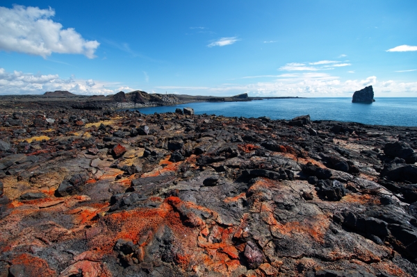
The rugged lava fields of Reykjanes, covering much of the lowlands of the peninsula, are a perfect testament to the volcanic power of the region. The last major period of volcanic activity on the Reykjanes peninsula began shortly before Iceland was settled, in the 8th and 9th centuries, and came to an end in the mid-13th century. In a series of 4–5 major eruptions, sixteen different lava fields were created. These young landscapes are still relatively barren, since very little vegetation other than moss has managed to colonize the hostile lava fields.
Black lava fields and green energy
The lava fields have been created by eruptions in the volcanic systems located along the peninsula. Each system has its own magma supply and is characterized by closely spaced fractures referred to as fissure swarms, which stretch in a southwest to northeast direction. Chains of craters, like the Eldvörp chain, west of the Blue Lagoon, are a perfect example of these forces. The steam rising from geothermal vents along the craters reminds us of the enormous power beneath the surface.

There are four major volcanic systems on the Reykjanes peninsula, two of which are within the Reykjanes Geopark: the Reykjanes and Krýsuvík systems. Two other major systems are just west of the Geopark: the Brennisteinsfjöll system and the Hengill fissure system. In addition to hundreds of open fissures, each system has a major high temperature geothermal system, characterized by intense surface activity that has created a diversity of colours contrasting with the black lava and the lush green moss.
The two major power plants in the Hengill system (Nesjavellir and Hellisheiði) supply the Capital region with much of its energy. The energy of the Reykjanes system, which is the westernmost of the volcanic systems, powers two major geothermal power plants, Reykjanes and Svartsengi.
Sustainable development, industry, and tourism
Geoparks were first proposed as a UNESCO programme in 1999, to combine conservation, sustainable development, and community involvement to protect and promote unique geological areas. Since its introduction, the idea has been adopted by increasing numbers of member states. There are over 120 Geoparks around the world. In September 2015, Reykjanes became the second Geopark in Iceland and the 66th member of the European Geoparks Network.

The creation of the Reykjanes Geopark reflects a growing awareness by locals of the enormous opportunities presented by the utilization of the resources created by the unique geology of the region. The region’s most obvious resource is the rugged landscape itself: the black lava fields, colourful geothermal areas, crater rows and volcanoes, and the basalt columns and cliffs along the shores. In recent years, a booming tourism industry has grown up to exploit this resource.
But a second, less visible resource is also found in abundance in the region: geothermal energy, which has in recent years been harnessed to power industry. Striking a balance between these different ways of exploiting the valuable resources of the region is an important challenge for the 22,000 people who inhabit the villages and towns of the five municipalities on the peninsula. The most popular tourist destination in the Geopark, the famous Blue Lagoon, shows that these two industries can find fascinating ways to work together.
The Blue Lagoon: from a makeshift secret pool to a world-famous tourist attraction
The most famous of the tourist attractions in the Reykjanes Geopark is the Blue Lagoon. A man-made lagoon, it is one of two blue water pools in Iceland (the other is Mývatn Nature Baths), and contains 9 million litres (2.4 million gallons) of 37-39°C (99-102°F) hot geothermal sea water. The mineral-rich water is actually the discharge water of the nearby Svartsengi power plant.

Fresh water and sea water, which can permeate the porous volcanic rock, is heated deep below the lava fields. At a depth of 250 meters (820 feet), the water reaches more than 200°C (390°F). The Svartsengi power plant uses this water to generate 75 MW of electricity and 150 MW in thermal energy. After the energy has been extracted from the water to power the local district heating utility and provide electricity for industry, the mineral-rich excess water is released into the nearby lava field.
When the first phase of the power plant was built in 1977-79, locals discovered that the pools of discharge water were actually great for bathing. It was only in 1987 that the first makeshift facilities were built at the site, including showers to wash before entering the pool, and perhaps more importantly, to wash off the silica after the relaxing bath. The popularity of the baths increased, and in 1999, the current facilities were opened. Recently the lagoon has been expanded to ensure it will be able to accommodate the 1,000,000 visitors who are expected this year.
One of two UNESCO-recognized areas of international geological significance in Iceland, the Reykjanes Geopark is a unique area. Sitting on the doorstep of Reykjavík, the area is full of natural and geological wonders, rugged lava fields, geothermal areas, and active volcanoes. Still, even though virtually all visitors to Iceland drive through the park on their way from the airport to the Capital region, it is frequently overlooked by visitors.
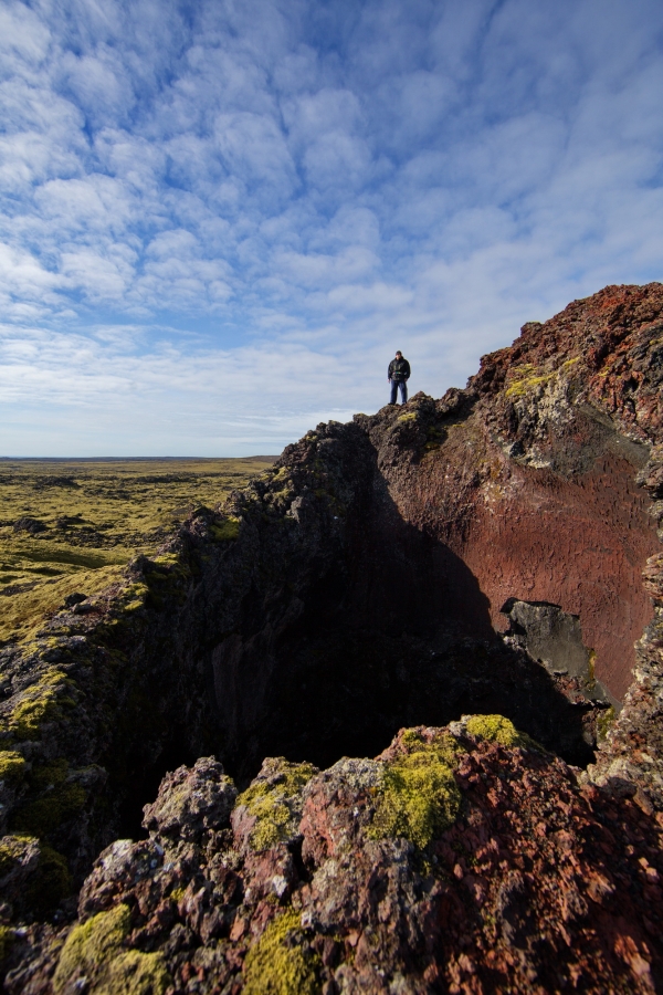
A barren desolate landscape
On Reykjanes peninsula, the Mid-Atlantic Ridge rises above sea level. The ridge, which stretches beneath the Atlantic Ocean from the Arctic to the Antarctic, is formed because the tectonic plates on either side are drifting 2 centimetres (0.8 inches) annually in opposite directions. Along the ridge, magma wells up, creating the longest mountain range on earth. The Reykjanes peninsula is in fact the only place on Earth where you can actually walk along the ridge, seeing up close how the forces of nature constantly create new land.
The 20 meter (66 feet) long footbridge, spanning one of the many fissures created by the drifting apart of the tectonic plates, has been built near the village of Hafnir on the west coast of Reykjanes peninsula, to symbolically bridge the continents
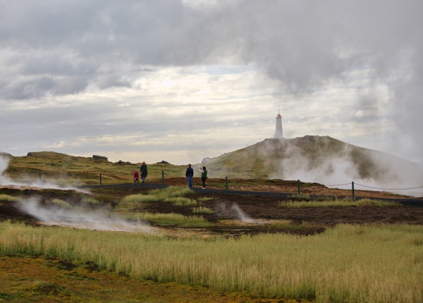
The rugged lava fields of Reykjanes, covering much of the lowlands of the peninsula, are a perfect testament to the volcanic power of the region. The last major period of volcanic activity on the Reykjanes peninsula began shortly before Iceland was settled, in the 8th and 9th centuries, and came to an end in the mid-13th century. In a series of 4–5 major eruptions, sixteen different lava fields were created. These young landscapes are still relatively barren, since very little vegetation other than moss has managed to colonize the hostile lava fields.
Black lava fields and green energy
The lava fields have been created by eruptions in the volcanic systems located along the peninsula. Each system has its own magma supply and is characterized by closely spaced fractures referred to as fissure swarms, which stretch in a southwest to northeast direction. Chains of craters, like the Eldvörp chain, west of the Blue Lagoon, are a perfect example of these forces. The steam rising from geothermal vents along the craters reminds us of the enormous power beneath the surface.
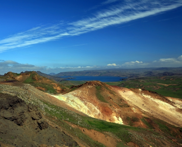
There are four major volcanic systems on the Reykjanes peninsula, two of which are within the Reykjanes Geopark: the Reykjanes and Krýsuvík systems. Two other major systems are just west of the Geopark: the Brennisteinsfjöll system and the Hengill fissure system. In addition to hundreds of open fissures, each system has a major high temperature geothermal system, characterized by intense surface activity that has created a diversity of colours contrasting with the black lava and the lush green moss.
The two major power plants in the Hengill system (Nesjavellir and Hellisheiði) supply the Capital region with much of its energy. The energy of the Reykjanes system, which is the westernmost of the volcanic systems, powers two major geothermal power plants, Reykjanes and Svartsengi.
Sustainable development, industry, and tourism
Geoparks were first proposed as a UNESCO programme in 1999, to combine conservation, sustainable development, and community involvement to protect and promote unique geological areas. Since its introduction, the idea has been adopted by increasing numbers of member states. There are over 120 Geoparks around the world. In September 2015, Reykjanes became the second Geopark in Iceland and the 66th member of the European Geoparks Network.
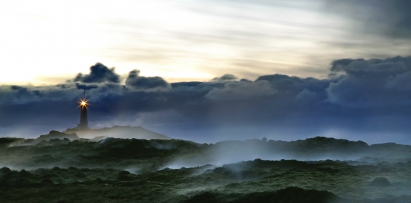
The creation of the Reykjanes Geopark reflects a growing awareness by locals of the enormous opportunities presented by the utilization of the resources created by the unique geology of the region. The region’s most obvious resource is the rugged landscape itself: the black lava fields, colourful geothermal areas, crater rows and volcanoes, and the basalt columns and cliffs along the shores. In recent years, a booming tourism industry has grown up to exploit this resource.
But a second, less visible resource is also found in abundance in the region: geothermal energy, which has in recent years been harnessed to power industry. Striking a balance between these different ways of exploiting the valuable resources of the region is an important challenge for the 22,000 people who inhabit the villages and towns of the five municipalities on the peninsula. The most popular tourist destination in the Geopark, the famous Blue Lagoon, shows that these two industries can find fascinating ways to work together.
The Blue Lagoon: from a makeshift secret pool to a world-famous tourist attraction
The most famous of the tourist attractions in the Reykjanes Geopark is the Blue Lagoon. A man-made lagoon, it is one of two blue water pools in Iceland (the other is Mývatn Nature Baths), and contains 9 million litres (2.4 million gallons) of 37-39°C (99-102°F) hot geothermal sea water. The mineral-rich water is actually the discharge water of the nearby Svartsengi power plant.
Fresh water and sea water, which can permeate the porous volcanic rock, is heated deep below the lava fields. At a depth of 250 meters (820 feet), the water reaches more than 200°C (390°F). The Svartsengi power plant uses this water to generate 75 MW of electricity and 150 MW in thermal energy. After the energy has been extracted from the water to power the local district heating utility and provide electricity for industry, the mineral-rich excess water is released into the nearby lava field.
When the first phase of the power plant was built in 1977-79, locals discovered that the pools of discharge water were actually great for bathing. It was only in 1987 that the first makeshift facilities were built at the site, including showers to wash before entering the pool, and perhaps more importantly, to wash off the silica after the relaxing bath. The popularity of the baths increased, and in 1999, the current facilities were opened. Recently the lagoon has been expanded to ensure it will be able to accommodate the 1,000,000 visitors who are expected this year.


