

Today, October 12 2018, marks the 100 year anniversary of the beginning of the last eruption in the monster volcano Katla, one of Iceland's largest and most powerful volcanoes. Out of the 32 active volcanoes in Iceland, Katla is considered to be one of the most dangerous. Another dangerous volcano that has been showing signs of activity recently is Öræfajökull.
Long overdue for an eruption
Katla is the fourth most active volcanic system in Iceland, having erupted at least 21 times since the Viking settlement of Iceland in the 9th century. During this time the volcano erupted on average once every 47 years. Historically the volcano is believed to erupt at least once every 60-80 years. This means Katla is long overdue for an eruption.
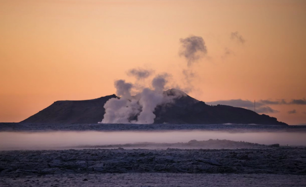
Katla has been showing clear signs of growing activity for the past several years. In September scientists published a study showing the volcano is emitting enormous quantities of CO2, far more than could be explained by geothermal activity in the caldera. The 20 kilotons of CO2 emitted by the volcano every day is more than all but two volcanoes in the world. It is not know whether the enormous quantity of CO2 which is being released is an indication of an impending eruption, or whether Katla serves as an exhaust vent from Hell, releasing CO2 from deep beneath the Earth's crust and the heart of the entire southern volcanic system.
Read more: We don't know one way or another if Katla is preparing to erupt, geophysicist argues
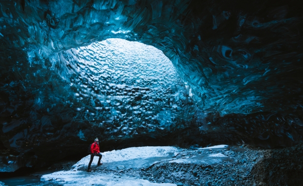
The main caldera of the Katla system is located beneath Mýrdalsjökull glacier, the fourth largest glacier in Iceland. The caldera is hidden beneath a 700 m (2,300 ft) thick ice cap of Mýrdalsjökull, but the system stretches 70 km (44 mi) north-east from Mýrdalsjökull into the Central Highlands in the direction of Síðujökull, one of the outlet glaciers of Vatnajökull.
Terrifying power
Katla erupts in explosive basalt eruptions, caused by the interaction of magma and the melting ice. The massive quantities of ash, tephra and tuff are deposited over the surrounding regions. In the absence of the ice cap and the interaction of melting ice and magma eruptions in Katla would most likely take the form of a lava flow.
Eruptions in Katla are accompanied by massive jökulhlaup, glacial outburst floods, caused by the sudden melting of large quantities of ice. These floods have usually burst out onto Mýrdalssandur outwash plain to the east of the village Vík, but floods are also known to have found their way into Markarfljót river at Þórsmörk Nature Preserve.
A jökulhlaup from Mýrdalsjökull, caused by an eruption in Katla, would cause significant disruption to transportation, cutting the Ring Road in half, either to the west of Seljalandsfoss waterfall or to the east of the village Vík. Earlier jökulhlaup caused by Katla, and the massive quantities of ash and tephra deposited over nearby aras, are believed to have laid waste to a large prosperous farming region on the wasteland east of Vík.
Read more: Katla: Iceland's most notorious volcano is kept under close surveillance
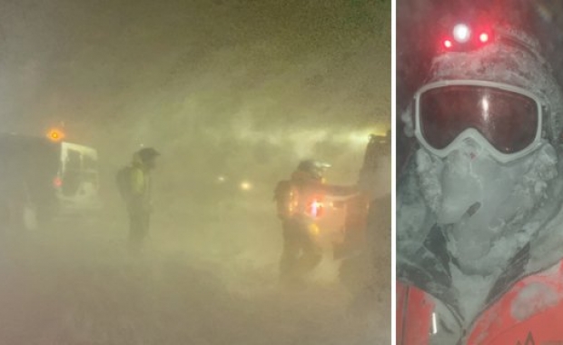
Due to the power and destructive potential of Katla the volcano is kept under constant and close surveillance by scientists and the Icelandic Civil Protection Agency.
Eruptions on the scale of Ragnarrök
The Katla system is also know to have erupted in massive lava eruptions that erupt from the fracture swarm to the NE of the main caldera. The last such eruption took place in 939 AD, producing 20 km3 (x sq mi) of lava. The 934 eruption is believed to be the largest volcanic eruption to take place in Iceland in the past millennia.
Read more: Danish research on Vikings and volcanoes: eruptions connected to a tale about the end of the world
The eruption produced a lava field which covers approximately 800 square kilometers (310 square miles), 18-20 cubic kilometers (4.3-4.8 cubic miles) of lava and 5-7 cubic kilometers (1.2-1.7 cubic miles) of tephra and ash. The size of the lava field is large enough to cover all of New York City, and then some. The impact of the eruption on global weather systems was catastrophic, causing crop failures and hunger in Europe. Temperatures all over the Northern Hemisphere dropped, causing rivers as far as present day Iran to have frozen over.
The giant eruption is believed to have inspired the descriptions of Ragnarrök, the end of the world in Viking mythology, as it is described in Völuspá.
Kept under close surveillance
Due to its destructive capacity Katla is kept under close surveillance. Ten different seismic monitors are located around the volcano, as well as a number of GPS monitors, and gas and hydrology monitors at the rivers carrying meltwater from the glacier. Monitoring slight shifts of the earth's crust around Katla, the volume of meltwater and the gas contents of the water allows scientists to assess the likelihood of an eruption.
Measurements in recent years do not indicate an imminent eruption, but there are strong indications of molten magma close to the surface in the volcano's caldera. It is not a question if, but when Katla will erupt. Based on its previous behavior an eruption will take place soon. Historically eruptions in Katla become progressively larger as the time lapsed since the last eruption becomes longer.
Read more: Authorities worry it will be impossible to warn travellers in time in case of Katla eruption
However, people should remember that volcanoes move on a geological time-scale, and when we say that a volcano will erupt soon we are not counting in days, weeks or even months – but years.
Today, October 12 2018, marks the 100 year anniversary of the beginning of the last eruption in the monster volcano Katla, one of Iceland's largest and most powerful volcanoes. Out of the 32 active volcanoes in Iceland, Katla is considered to be one of the most dangerous. Another dangerous volcano that has been showing signs of activity recently is Öræfajökull.
Long overdue for an eruption
Katla is the fourth most active volcanic system in Iceland, having erupted at least 21 times since the Viking settlement of Iceland in the 9th century. During this time the volcano erupted on average once every 47 years. Historically the volcano is believed to erupt at least once every 60-80 years. This means Katla is long overdue for an eruption.
Katla has been showing clear signs of growing activity for the past several years. In September scientists published a study showing the volcano is emitting enormous quantities of CO2, far more than could be explained by geothermal activity in the caldera. The 20 kilotons of CO2 emitted by the volcano every day is more than all but two volcanoes in the world. It is not know whether the enormous quantity of CO2 which is being released is an indication of an impending eruption, or whether Katla serves as an exhaust vent from Hell, releasing CO2 from deep beneath the Earth's crust and the heart of the entire southern volcanic system.
Read more: We don't know one way or another if Katla is preparing to erupt, geophysicist argues
The main caldera of the Katla system is located beneath Mýrdalsjökull glacier, the fourth largest glacier in Iceland. The caldera is hidden beneath a 700 m (2,300 ft) thick ice cap of Mýrdalsjökull, but the system stretches 70 km (44 mi) north-east from Mýrdalsjökull into the Central Highlands in the direction of Síðujökull, one of the outlet glaciers of Vatnajökull.
Terrifying power
Katla erupts in explosive basalt eruptions, caused by the interaction of magma and the melting ice. The massive quantities of ash, tephra and tuff are deposited over the surrounding regions. In the absence of the ice cap and the interaction of melting ice and magma eruptions in Katla would most likely take the form of a lava flow.
Eruptions in Katla are accompanied by massive jökulhlaup, glacial outburst floods, caused by the sudden melting of large quantities of ice. These floods have usually burst out onto Mýrdalssandur outwash plain to the east of the village Vík, but floods are also known to have found their way into Markarfljót river at Þórsmörk Nature Preserve.
A jökulhlaup from Mýrdalsjökull, caused by an eruption in Katla, would cause significant disruption to transportation, cutting the Ring Road in half, either to the west of Seljalandsfoss waterfall or to the east of the village Vík. Earlier jökulhlaup caused by Katla, and the massive quantities of ash and tephra deposited over nearby aras, are believed to have laid waste to a large prosperous farming region on the wasteland east of Vík.
Read more: Katla: Iceland's most notorious volcano is kept under close surveillance
Due to the power and destructive potential of Katla the volcano is kept under constant and close surveillance by scientists and the Icelandic Civil Protection Agency.
Eruptions on the scale of Ragnarrök
The Katla system is also know to have erupted in massive lava eruptions that erupt from the fracture swarm to the NE of the main caldera. The last such eruption took place in 939 AD, producing 20 km3 (x sq mi) of lava. The 934 eruption is believed to be the largest volcanic eruption to take place in Iceland in the past millennia.
Read more: Danish research on Vikings and volcanoes: eruptions connected to a tale about the end of the world
The eruption produced a lava field which covers approximately 800 square kilometers (310 square miles), 18-20 cubic kilometers (4.3-4.8 cubic miles) of lava and 5-7 cubic kilometers (1.2-1.7 cubic miles) of tephra and ash. The size of the lava field is large enough to cover all of New York City, and then some. The impact of the eruption on global weather systems was catastrophic, causing crop failures and hunger in Europe. Temperatures all over the Northern Hemisphere dropped, causing rivers as far as present day Iran to have frozen over.
The giant eruption is believed to have inspired the descriptions of Ragnarrök, the end of the world in Viking mythology, as it is described in Völuspá.
Kept under close surveillance
Due to its destructive capacity Katla is kept under close surveillance. Ten different seismic monitors are located around the volcano, as well as a number of GPS monitors, and gas and hydrology monitors at the rivers carrying meltwater from the glacier. Monitoring slight shifts of the earth's crust around Katla, the volume of meltwater and the gas contents of the water allows scientists to assess the likelihood of an eruption.
Measurements in recent years do not indicate an imminent eruption, but there are strong indications of molten magma close to the surface in the volcano's caldera. It is not a question if, but when Katla will erupt. Based on its previous behavior an eruption will take place soon. Historically eruptions in Katla become progressively larger as the time lapsed since the last eruption becomes longer.
Read more: Authorities worry it will be impossible to warn travellers in time in case of Katla eruption
However, people should remember that volcanoes move on a geological time-scale, and when we say that a volcano will erupt soon we are not counting in days, weeks or even months – but years.