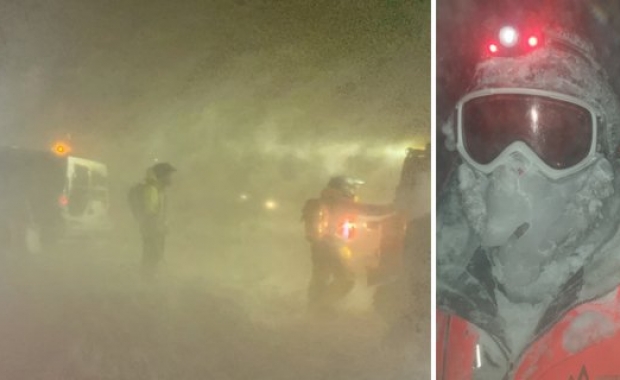

Travel conditions can get challenging on mountain roads around Iceland today. The Icelandic Met Office (IMO) is expecting snow and icing on roads that are 200 to 300 meters (656-984 ft) above sea level so be careful if you are planning a road trip.
You can follow road conditions around Iceland live via the Icelandic Road and Coastal Administration’s (IRCA) web cams.
IMO’s forecast for today and the rest of the week
Today: Slowly increasing southeast wind, 8 to 13 m/s (18-29 mph/ 29-47 km/h) in the afternoon. Rain or sleet, but dry in the north and east at first. Turns to lighter southwest wind in the southwest by evening. Temperature 0 to 8 degrees C (32-46 F) during the day, mildest in the south.
On Wednesday: Northerly wind, widely 8 to 13 m/s (18-29 mph/ 29-47 km/h). Sleet or rain and then snow showers in the north, elsewhere mainly dry. Slowly increasing southeast wind and rain today, but dry in the northeast until afternoon. East 8 to 18 m/s (18-40 mph/ 29-64 km/h) and rain or sleet in the afternoon, Becoming light southwest wind in the evening. Temperature 0 to 8 deg. C (32-46 F) during the day warmest in the south.
On Thursday: Light northerly wind and mainly dry in the morning. Increasing easterly wind by afternoon, widely 10 to 15 m/s (22-34 mph/ 36-54 km/h) by evening and rain in the south. Temperature 0 to 6 degrees C (32-43 F) but light frost in some places inland.
On Friday: Rather light southerly wind and rain- or sleet showers, but dry and fair in the north and east. Temperature 0 to 6 degrees C (32-43 F). Becoming north gale with sleet or snow in the northwest by noon.