
Skógafoss waterfall
With a drop of 60 metres (200 ft) and a width of 25 metres (82 ft), Skógafoss waterfall is one of Iceland’s biggest and most famous waterfalls. A Viking named Þrasi Þórólfsson was the first to settle the area and the legend says that he hid his fortune in a cave located behind the massive waterfall.

Vík in Mýrdalur
This small town is the southernmost village in Iceland. It sits directly below Mýrdalsjökull glacier and next to the beautiful, the inky-black sands of Reynisfjara beach. Please note, the black sand can be a dangerous place and here have been numerous accounts where foreign visitors have been caught in the strong undertow in Reynisfjara.

Rauðisandur beach
Rauðisandur means ‘red sand’ and is located near Látrabjarg cliffs in the Westfjords. A small café is located on the beach, open only during the summer, where one can stop for refreshments after taking in the breath-taking scenery and unique tranquillity of the place.

Vestmannaeyjar Islands
Vestmannaeyjar is a cluster of islands located south of Hvolsvöllur, most famous for the 1974 eruption of Eldfell, Surtsey island, and Heimaklettur cliff. Heimaklettur is a 279 meters high palagonite cliff that has become an emblem of sorts for the island. Geologically speaking, it is one of the oldest parts of the island, dating back ten thousand years.

Akureyri
Akureyri is Iceland‘s second largest urban area after the greater Reykjavík area and often dubbed ‘the capital of the North’. The town is located in the scenic Eyjafjörður fjord in North Iceland.

Landmannalaugar
The Landmannalaugar area in the central highlands boast a natural geothermal pool, flanked by steep, black lava fields and many incredible hiking trails. You'll also find Ljótipollur, or Ugly Puddle, in the Landmannalaugar area. The lake was formed during an explosive volcanic eruption in 1477 and is packed with brown trout that is quite popular with fishing enthusiasts.

Jökulsá á Fjöllum
Jökulsá á Fjöllum is Iceland’s second longest river, running for 206 kilometres (128 miles). The river has its source in Vatnajökull, Iceland’s, and Europe’s, largest ice cap. The source of the river is Vatnajökull glacier, Iceland’s and Europe’s largest ice mass. Jökulsá forms Selfoss, Dettifoss, and Hafragilsfoss waterfalls during its course. Its river course was somewhat altered during the Holuhraun eruption.

Dettifoss waterfall
Located in northeast Iceland, Dettifoss waterfall is believed to be the most powerful waterfall in Europe. It is a 100 metres (330 ft) wide and has a drop of 45 metres (150 ft) into the magnificent Jökulsárgljúfur canyon.

Lake Mývatn
Lake Mývatn is a shallow eutrophic lake situated not far from Krafla volcano and was created by a large basaltic lava eruption over 2300 years ago. Its name, which derives from large swarms of midge found near the lake during summer, literally translates to Midge Lake.
Nearby one will find Iceland’s other blue lagoon, the Mývatn Nature Baths. The lagoon is a man-made lagoon and its temperatures range between 36-40 degrees Celsius.

Reykjadalur valley
Reykjadalur valley is located above the village of Hveragerði in south Iceland. It has become one of the most popular hiking areas within Reykjavík’s vicinity. The valley is dotted with colourful landscapes and hot springs one can bathe in.

Seyðisfjörður village
Seyðisfjörður is a beautiful, small village located in the eponymous fjord in east Iceland. Travellers sailing from mainland Europe to Iceland on the Norræna ferry come ashore in Seyðisfjörður. The town is also a popular destination for young and aspiring artists, attracted by the lUNGA art festival that takes place in mid-July each year.

Gullfoss waterfall
Gullfoss waterfall is one of Iceland’s most visited attractions. At first, the waterfall’s crevice is obscured from view which makes it seem as though the massive waterfall simply vanishes into the earth. A truly magnificent view.

Kirkjubæjarklaustur village
Kirkjubæjarklaustur is a tiny village in southeast Iceland. It’s believed to have been settled by Irish monks long before the Vikings made Iceland their home. The town’s surroundings are quite charming and attractions such as the Laki craters, Skaftafell and Vatnajökull National Park are all within close proximity.

Jökulsárlón glacial lagoon
Jökulsárlón literally means glacial river lagoon. The lake is 22 km2 (8.5 sq mi) in size, covering an area from the base of Vatnajökull to the edge of Iceland’s southeast coast. Only a sliver of solid ground separates it from the North Atlantic Ocean. With its luminous blue-white icebergs floating around in the cool water, Jökulsárlón has become one of Iceland’s most spectacular natural wonders.

Ásbyrgi canyon
Ásbyrgi is a 3.5 kilometre (1.86 mile) long and 1.1 km (0.6 mi) wide canyon, located east of Húsavík, North Iceland. The canyon is divided in the middle, for nearly half of its length, by a 25 metre (82 feet) high rock known as “Eyjan” (the Island). The canyon is known for its unique horseshoe shape, green forests that nestle within the cliffs, and its pristine lakes, filled with wildlife.
Many myths surround Ásbyrgi. Some say it was formed when the heathen god Óðinn’s eight-legged horse, Sleipnir, touched the ground there.

Flatey Island
This beautiful island is accessible by ferry from the town of Stykkishólmur, Snæfellsnes peninsula. Inhabited mainly in the summer, the island is home to an old church that houses both the oldest and the smallest library in Iceland. The island has only one road, which leads from the ferry dock to the old village.
From the tiny village of Vík in the south to Rauðisandur beach in the Westfjords, here are some of Iceland’s best destinations as suggested by our readers.
Skógafoss waterfall
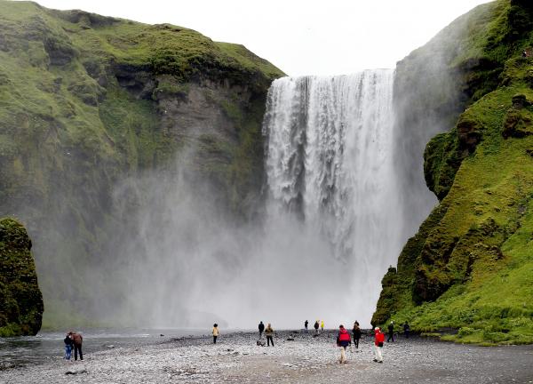
With a drop of 60 metres (200 ft) and a width of 25 metres (82 ft), Skógafoss waterfall is one of Iceland’s biggest and most famous waterfalls. A Viking named Þrasi Þórólfsson was the first to settle the area and the legend says that he hid his fortune in a cave located behind the massive waterfall.
Vík in Mýrdalur
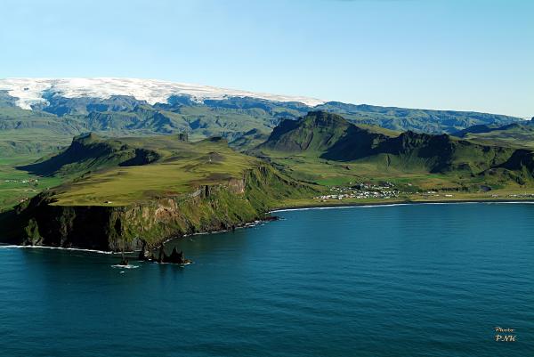
This small town is the southernmost village in Iceland. It sits directly below Mýrdalsjökull glacier and next to the beautiful, the inky-black sands of Reynisfjara beach. Please note, the black sand can be a dangerous place and here have been numerous accounts where foreign visitors have been caught in the strong undertow in Reynisfjara.
Rauðisandur beach
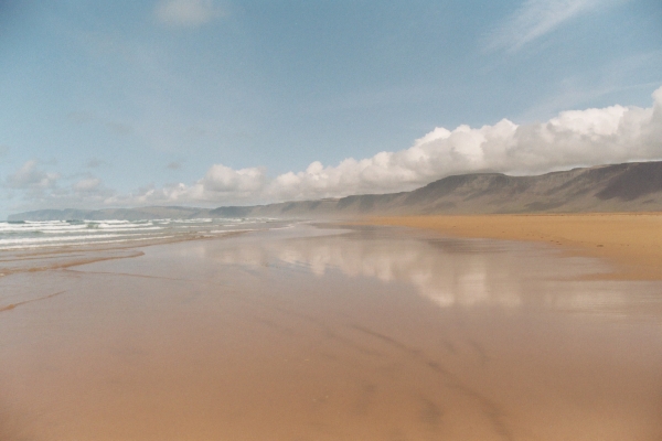
Rauðisandur means ‘red sand’ and is located near Látrabjarg cliffs in the Westfjords. A small café is located on the beach, open only during the summer, where one can stop for refreshments after taking in the breath-taking scenery and unique tranquillity of the place.
Vestmannaeyjar Islands
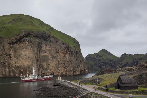
Vestmannaeyjar is a cluster of islands located south of Hvolsvöllur, most famous for the 1974 eruption of Eldfell, Surtsey island, and Heimaklettur cliff. Heimaklettur is a 279 meters high palagonite cliff that has become an emblem of sorts for the island. Geologically speaking, it is one of the oldest parts of the island, dating back ten thousand years.
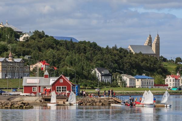
Akureyri
Akureyri is Iceland‘s second largest urban area after the greater Reykjavík area and often dubbed ‘the capital of the North’. The town is located in the scenic Eyjafjörður fjord in North Iceland.
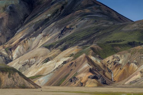
Landmannalaugar
The Landmannalaugar area in the central highlands boast a natural geothermal pool, flanked by steep, black lava fields and many incredible hiking trails. You'll also find Ljótipollur, or Ugly Puddle, in the Landmannalaugar area. The lake was formed during an explosive volcanic eruption in 1477 and is packed with brown trout that is quite popular with fishing enthusiasts.
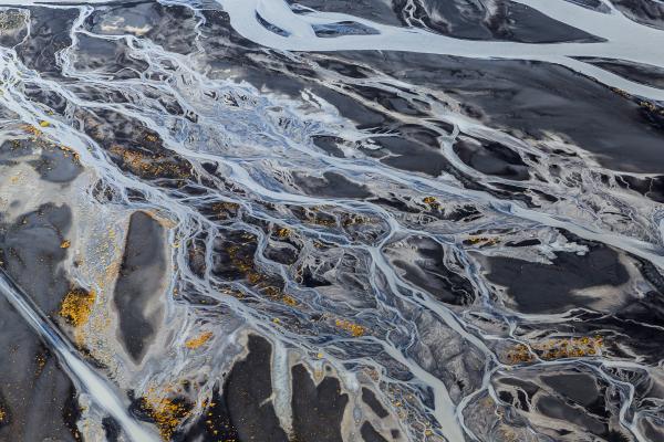
Jökulsá á Fjöllum
Jökulsá á Fjöllum is Iceland’s second longest river, running for 206 kilometres (128 miles). The river has its source in Vatnajökull, Iceland’s, and Europe’s, largest ice cap. The source of the river is Vatnajökull glacier, Iceland’s and Europe’s largest ice mass. Jökulsá forms Selfoss, Dettifoss, and Hafragilsfoss waterfalls during its course. Its river course was somewhat altered during the Holuhraun eruption.
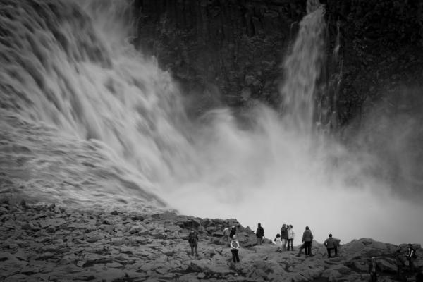
Dettifoss waterfall
Located in northeast Iceland, Dettifoss waterfall is believed to be the most powerful waterfall in Europe. It is a 100 metres (330 ft) wide and has a drop of 45 metres (150 ft) into the magnificent Jökulsárgljúfur canyon.
Lake Mývatn
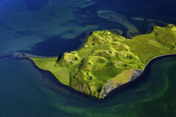
Lake Mývatn is a shallow eutrophic lake situated not far from Krafla volcano and was created by a large basaltic lava eruption over 2300 years ago. Its name, which derives from large swarms of midge found near the lake during summer, literally translates to Midge Lake.
Nearby one will find Iceland’s other blue lagoon, the Mývatn Nature Baths. The lagoon is a man-made lagoon and its temperatures range between 36-40 degrees Celsius.
Reykjadalur valley
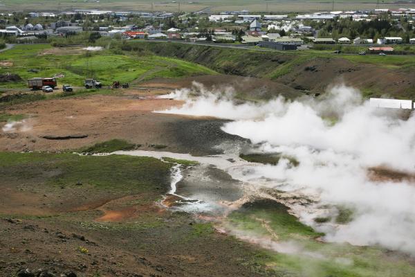
Reykjadalur valley is located above the village of Hveragerði in south Iceland. It has become one of the most popular hiking areas within Reykjavík’s vicinity. The valley is dotted with colourful landscapes and hot springs one can bathe in.
Seyðisfjörður village
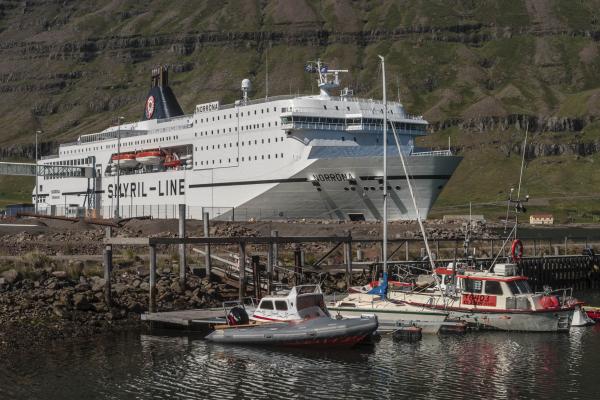
Seyðisfjörður is a beautiful, small village located in the eponymous fjord in east Iceland. Travellers sailing from mainland Europe to Iceland on the Norræna ferry come ashore in Seyðisfjörður. The town is also a popular destination for young and aspiring artists, attracted by the lUNGA art festival that takes place in mid-July each year.
Gullfoss waterfall
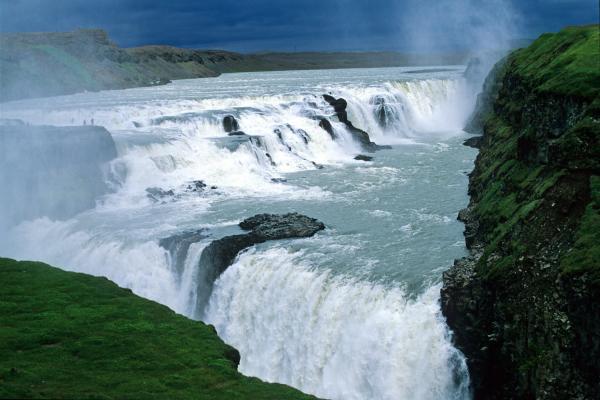
Gullfoss waterfall is one of Iceland’s most visited attractions. At first, the waterfall’s crevice is obscured from view which makes it seem as though the massive waterfall simply vanishes into the earth. A truly magnificent view.
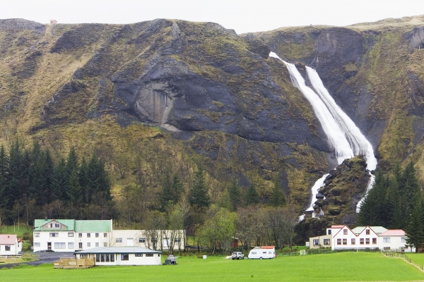
Kirkjubæjarklaustur village
Kirkjubæjarklaustur is a tiny village in southeast Iceland. It’s believed to have been settled by Irish monks long before the Vikings made Iceland their home. The town’s surroundings are quite charming and attractions such as the Laki craters, Skaftafell and Vatnajökull National Park are all within close proximity.
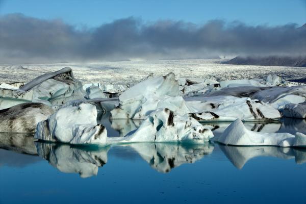
Jökulsárlón glacial lagoon
Jökulsárlón literally means glacial river lagoon. The lake is 22 km2 (8.5 sq mi) in size, covering an area from the base of Vatnajökull to the edge of Iceland’s southeast coast. Only a sliver of solid ground separates it from the North Atlantic Ocean. With its luminous blue-white icebergs floating around in the cool water, Jökulsárlón has become one of Iceland’s most spectacular natural wonders.
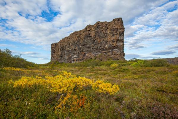
Ásbyrgi canyon
Ásbyrgi is a 3.5 kilometre (1.86 mile) long and 1.1 km (0.6 mi) wide canyon, located east of Húsavík, North Iceland. The canyon is divided in the middle, for nearly half of its length, by a 25 metre (82 feet) high rock known as “Eyjan” (the Island). The canyon is known for its unique horseshoe shape, green forests that nestle within the cliffs, and its pristine lakes, filled with wildlife.
Many myths surround Ásbyrgi. Some say it was formed when the heathen god Óðinn’s eight-legged horse, Sleipnir, touched the ground there.
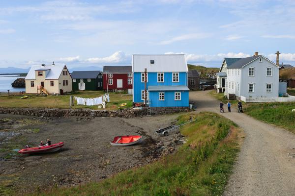
Flatey Island
This beautiful island is accessible by ferry from the town of Stykkishólmur, Snæfellsnes peninsula. Inhabited mainly in the summer, the island is home to an old church that houses both the oldest and the smallest library in Iceland. The island has only one road, which leads from the ferry dock to the old village.


