From Reykavík, one can enjoy an amazing panoramic mountain view – but can you name those mountains?

Mount Esja
Height: 914 m (2999 feet)
Mount Esja, most often referred to as Esjan which translates directly to ‘The Esja’, is a volcanic mountain range situated on the south-west of Iceland and visible from most parts of Reykjavík.
Esja is comprised of basalt and tuff and the oldest part of the mountain range is around 3.2 million years old. There are many beautiful hiking trails up and around the mountain.

Mount Keilir
Height: 379 metres (1243 feet)
Keilir is a cone shaped palagonite mountain located on the Reykjanes Peninsula. The mountain is a popular hike among locals.

Mount Akrafjall
Height: 643 metres (2110 feet)
Akrafjall is a basalt mountain situated near the town of Akranes on the west coast of Iceland. It is a popular nesting ground for the great black-backed gull and the fulmar. Akrafjall’s highest peak is Geirmundartindur (Geirmundur Peak).

Skarðsheiði
Height: 1000 metres (3281 feet)
Skarðsheiði is a mountain range that stretches between the fjords of Borgarfjörður and Hvalfjörður on the south-west of Iceland. Seeing it is a mountain range, it has many peaks, the highest of which reach up to 1000 metres above sea-level.

Hengilsvæðið / Hengill Mountain
Hight: 803 metres (2635 feet)
Hengilsvæðið is a volcanic mountain range situated south of Þingvellir National Park and covers an area of about 100 km² (62 square miles).

Vífilfell / Mount Vífilfell
Height: 655 metres (2149 feet)
Vífilfell, also known as Vífilsfell, is the northern most part of the Bláfjöll mountain range east of Reykjavík. It is thought to be named after Ingólfur Arnarson’s slave, Vífill, who is said to have regularly hiked up the mountain in order to try and forecast the weather.

Snæfellsjökull / Snæfellsjökull Glacier
Hight: 1446 metres (4744 feet)
On a sunny day the Snæfellsjökull Glacier is clearly visible from Reykjavík. Situated on the most western part of Snæfellsnes Peninsula, the glacier covers the summit of Snæfell, a seven thousand-year-old stratovolcano.
Snæfellsjökull, meaning Snow Mountain Glacier, is featured in Jules Verne’s novel Journey to the Centre of the Earth from 1864, in which the protagonists find the entrance to a passage leading to the centre of the earth on Snæfellsjökull.
From Reykavík, one can enjoy an amazing panoramic mountain view – but can you name those mountains?

Mount Esja
Height: 914 m (2999 feet)
Mount Esja, most often referred to as Esjan which translates directly to ‘The Esja’, is a volcanic mountain range situated on the south-west of Iceland and visible from most parts of Reykjavík.
Esja is comprised of basalt and tuff and the oldest part of the mountain range is around 3.2 million years old. There are many beautiful hiking trails up and around the mountain.
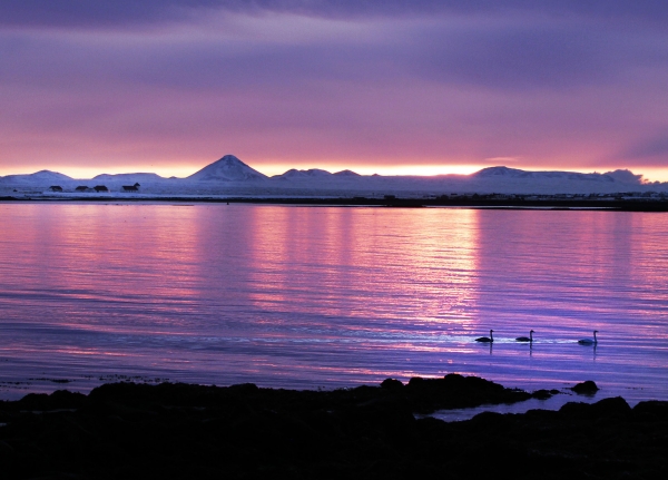
Mount Keilir
Height: 379 metres (1243 feet)
Keilir is a cone shaped palagonite mountain located on the Reykjanes Peninsula. The mountain is a popular hike among locals.
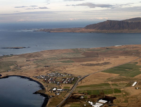
Mount Akrafjall
Height: 643 metres (2110 feet)
Akrafjall is a basalt mountain situated near the town of Akranes on the west coast of Iceland. It is a popular nesting ground for the great black-backed gull and the fulmar. Akrafjall’s highest peak is Geirmundartindur (Geirmundur Peak).
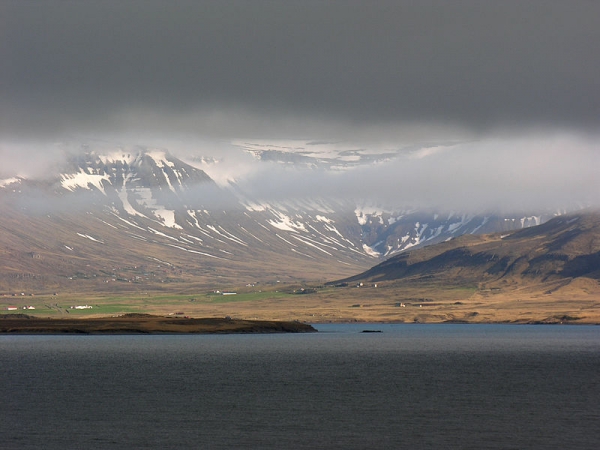
Skarðsheiði
Height: 1000 metres (3281 feet)
Skarðsheiði is a mountain range that stretches between the fjords of Borgarfjörður and Hvalfjörður on the south-west of Iceland. Seeing it is a mountain range, it has many peaks, the highest of which reach up to 1000 metres above sea-level.
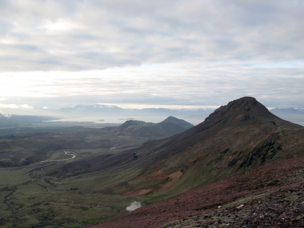
Hengilsvæðið / Hengill Mountain
Hight: 803 metres (2635 feet)
Hengilsvæðið is a volcanic mountain range situated south of Þingvellir National Park and covers an area of about 100 km² (62 square miles).
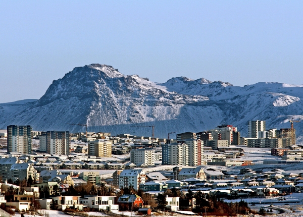
Vífilfell / Mount Vífilfell
Height: 655 metres (2149 feet)
Vífilfell, also known as Vífilsfell, is the northern most part of the Bláfjöll mountain range east of Reykjavík. It is thought to be named after Ingólfur Arnarson’s slave, Vífill, who is said to have regularly hiked up the mountain in order to try and forecast the weather.
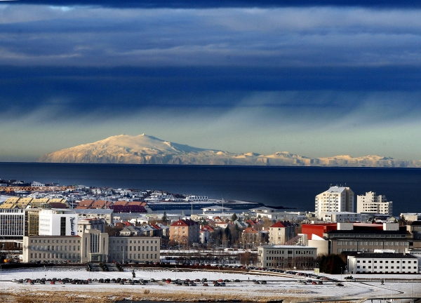
Snæfellsjökull / Snæfellsjökull Glacier
Hight: 1446 metres (4744 feet)
On a sunny day the Snæfellsjökull Glacier is clearly visible from Reykjavík. Situated on the most western part of Snæfellsnes Peninsula, the glacier covers the summit of Snæfell, a seven thousand-year-old stratovolcano.
Snæfellsjökull, meaning Snow Mountain Glacier, is featured in Jules Verne’s novel Journey to the Centre of the Earth from 1864, in which the protagonists find the entrance to a passage leading to the centre of the earth on Snæfellsjökull.


