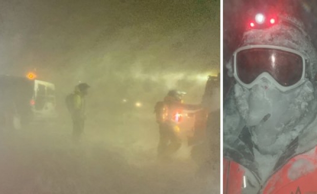
UPDATE, Thursday Sept 20: Snow, poor driving conditions on mountain roads, Ring Road at high elevations
The first storm of the winter is expected to make landfall today, bringing with it snow and sleet and winter driving conditions. Conditions on heaths, mountain roads, and the Ring Road at higher elevations, are expected to become difficult. The good news is that the Icelandic Meteorological Office has downgraded its earliest warnings for the storm: The weather will not be as bad as initially feared.
According to the current forecast conditions on lower elevations and in South-West Iceland will not be as bad as initially feared, and start off more slowly than the first forecast expected.
Wednesday
Today, Wednesday September 19, the IMO has issued a Yellow Weather Alerts for all of Iceland, except the West and South. Conditions will be worst in the Central Highlands, where 15-25 m/s (33-56 mph) gale force winds with sleet and snow are expected from noon. In the South East, south of Vatnajökull glacier, strong gales 18-25 m/s (40-56 mph) with potentially dangerous wind gusts and blowing sand on the plains south of Vatnajökull create extremely challenging driving conditions.
By late afternoon the storm will have picked up along the entire northern coast, with a northeasterly and northerly gale bringing rain, sleet and snow in mountains and at higher altitudes. Expect poor driving conditions on mountain roads, heaths and in mountain passes.
ICE-SAR has issued a travel warning, advising people that there are no travel, hiking or camping conditions in the interior and in mountains. Travelers are advised to postpone or cancel any travel plans in the Central Highlands.
The weather in South and West Iceland are expected to remain better today, with mostly clear skies but strong winds, especially near mountains in the south and west. Wind speeds of 10-14 m/s (22-31 mph).
ICE-SAR warns that strong localized winds can develop near mountains, creating conditions which are hazardous to RVs, camper vans and other vehicles susceptible to wind.
Thursday
The weather is not expected to improve much tomorrow, Thursday September 20, except in the south-east of Iceland. Gale force winds, sleet and snow are expected in the north, east and Central Highlands throughout the day. Conditions in the South East are expeted to have improved by early morning tomorrow.
Friday
The IMO cautions that it is still too early to say what the weather on Friday will look like, but people are still being told to expect a full-blown winter storm, although the severity has been downgraded.
On Friday, northwesterly gales (15-20 m/s) are forecast in North- and East-Iceland with precipitation, rain near sea level, but sleet or snow more than 100-200 meters above sea level. Roads in those areas can become covered in snow with slippy and difficult driving conditions. The forecast for Friday is still uncertain. The latest and likeliest forecast from today indicates less precipitation and wind than yesterdays forecast.
Travelers are urged to keep up to date with weather alerts and the forecast on vedur.is, any travel warnings at safetravel.is and road conditions on the website of the Icelandic Road and Coastal Authority.


